Projects
County Hall, Nottingham

Client
Faithful and Gould
Budget
£62,000
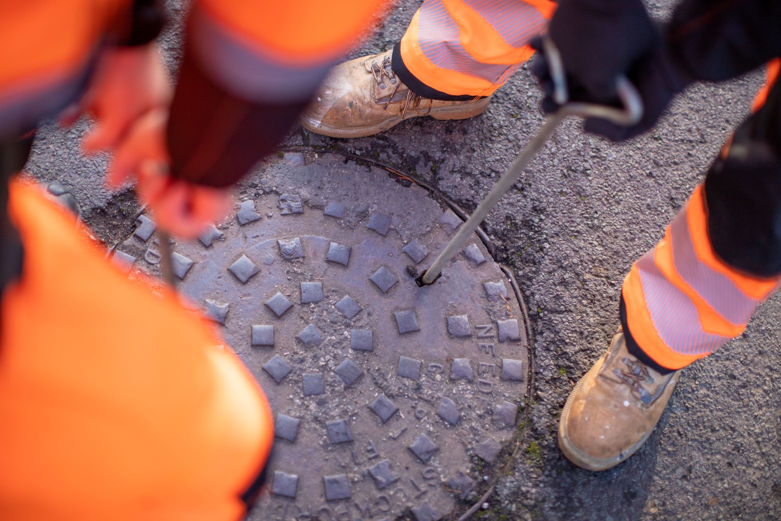
PAS128 type B Utilities & CCTV survey – with 3D outputs
We were commissioned to conduct multiple surveys of the County Hall in Nottingham, current headquarters of Nottinghamshire County and council built in 1954. Unique features of the building include a copper roof that has turned green over the years and is noticeable from miles around. There is also intricate statues at the front of the building depicting the counties mining history.
The Council approached Survey Hub with a project scope to
The project scope included creating a highly detailed digital 3D Revit model of the County Hall building and to successfully locate all the utility and drainage features included within the site boundary, to produce both 2D & 3D survey drawings to the required PAS128 specification. A detailed CCTV drainage condition report was also issued to WRC standards.

The model needed to be both accurately measured via laser scanning techniques, as well quickly captured within a window of opportunity for access whilst the building was scheduled to be vacated.
For the underground survey we used a CCTV pushrod camera, Cable Avoidance Tool & Signal Transmitter, and GPR to successfully complete the PAS128 survey. Our findings were surveyed in using total station and merged onto the site control established by our topographical team, and featured on the final Revit model.
The project specification required a Revit model of the Nottingham County Hall building in high level of detail. This included the Architrave beams and material finishes; thus, they required laser scanners that not only had the ability to colour the point cloud, but also to capture detail in good quality to enable our modelling team to extract the required detail.
They also needed a solution to capture the required data as quickly as possible, working to the tight time frames set by the council to work whilst the building would be unoccupied. To overcome the challenges of the project, Survey Hub utilised a pair of Leica ScanStation P-Series laser scanning solutions. Two members of the Survey Hub team completed an external traverse loop around the building perimeter with traversed stairwells and cross braces throughout the building floors. Whilst this was being completed, extra team members proceeded to capture the bulk of the detail within the building at each floor level with more mobile scanning units in the form of RTC 360 scanners.
Once all the traverse was complete and registered using Leica Cyclone CORE, the team linked the scan data back to the original traverse system to ensure accuracy remained high. We then continued to add in the detail capture scans obtained using the RTC 360 scanners to complete the registration in full.
The Revit model was produced directly from the captured point cloud and where need to model some of the features, we utilised Photogrammetry. For full details of this please see our separate County Hall Revit blog post.
